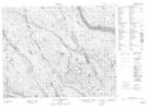
Maps showing Rivière Matshehu, Petit-Mécatina; Minganie, Quebec
Rivière Matshehu is a River located in Petit-Mécatina; Minganie, Quebec.
- Latitude: 51° 52' 48'' North (decimal: 51.8800630)
- Longitude: 61° 41' 51'' West (decimal: -61.6975584)
- Topography Feature Category: River
- Geographical Feature: Rivière
- Canadian Province/Territory: Quebec
- Location: Petit-Mécatina; Minganie
- Atlas of Canada Locator Map: Rivière Matshehu
- GPS Coordinate Locator Map: Rivière Matshehu Lat/Long
Rivière Matshehu NTS Map Sheets