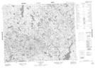
Maps showing Lac Minahkuat Kapukanant, Petit-Mécatina; Minganie, Quebec
Lac Minahkuat Kapukanant is a Lake located in Petit-Mécatina; Minganie, Quebec.
- Latitude: 51° 10' 6'' North (decimal: 51.1684072)
- Longitude: 60° 21' 13'' West (decimal: -60.3536263)
- Topography Feature Category: Lake
- Geographical Feature: Lac
- Canadian Province/Territory: Quebec
- Location: Petit-Mécatina; Minganie
- Atlas of Canada Locator Map: Lac Minahkuat Kapukanant
- GPS Coordinate Locator Map: Lac Minahkuat Kapukanant Lat/Long
Lac Minahkuat Kapukanant NTS Map Sheets