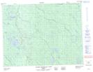
Maps showing Tourbière Shapayauschekw, Baie-James; Jamésie, Quebec
Tourbière Shapayauschekw is a Low vegetation located in Baie-James; Jamésie, Quebec.
- Latitude: 50° 36' 8'' North (decimal: 50.6022222)
- Longitude: 78° 54' 30'' West (decimal: -78.9083332)
- Topography Feature Category: Low vegetation
- Geographical Feature: Tourbière
- Canadian Province/Territory: Quebec
- Location: Baie-James; Jamésie
- Atlas of Canada Locator Map: Tourbière Shapayauschekw
- GPS Coordinate Locator Map: Tourbière Shapayauschekw Lat/Long
Tourbière Shapayauschekw NTS Map Sheets