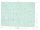
Maps showing Petits rapides Devil, Lac-Nilgaut; Pontiac, Quebec
Petits rapides Devil is a Falls located in Lac-Nilgaut; Pontiac, Quebec.
- Latitude: 46° 17' 45'' North (decimal: 46.2958333)
- Longitude: 76° 49' 14'' West (decimal: -76.8205556)
- Topography Feature Category: Falls
- Geographical Feature: Chute
- Canadian Province/Territory: Quebec
- Location: Lac-Nilgaut; Pontiac
- GPS Coordinate Locator Map: Petits rapides Devil Lat/Long
Petits rapides Devil NTS Map Sheets