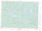
Maps showing Ruisseau Wolverene, Lac-Nilgaut; Pontiac, Quebec
Ruisseau Wolverene is a River located in Lac-Nilgaut; Pontiac, Quebec and has an elevation of 311 meters.
- Latitude: 46° 23' 31'' North (decimal: 46.3920035)
- Longitude: 77° 27' 33'' West (decimal: -77.4591853)
- Topography Feature Category: River
- Geographical Feature: Ruisseau
- Canadian Province/Territory: Quebec
- Elevation: 311 meters
- Location: Lac-Nilgaut; Pontiac
- GPS Coordinate Locator Map: Ruisseau Wolverene Lat/Long
Ruisseau Wolverene NTS Map Sheets