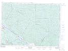
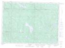
Maps showing Anse du Débarcadère, Chichester; Pontiac, Quebec
Anse du Débarcadère is a Bay located in Chichester; Pontiac, Quebec and has an elevation of 236 meters.
- Latitude: 46° 4' 18'' North (decimal: 46.0716667)
- Longitude: 77° 5' 53'' West (decimal: -77.0980555)
- Topography Feature Category: Bay
- Geographical Feature: Anse
- Canadian Province/Territory: Quebec
- Elevation: 236 meters
- Location: Chichester; Pontiac
- Atlas of Canada Locator Map: Anse du Débarcadère
- GPS Coordinate Locator Map: Anse du Débarcadère Lat/Long
Anse du Débarcadère NTS Map Sheets