Maps showing Passe Kaupauhkach, Baie-James; Jamésie, Quebec
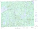
Passe Kaupauhkach is a Channel located in Baie-James; Jamésie, Quebec.
- Latitude: 50° 11' 13'' North (decimal: 50.1869444)
- Longitude: 73° 52' 30'' West (decimal: -73.875)
- Topography Feature Category: Channel
- Geographical Feature: Passe
- Canadian Province/Territory: Quebec
- Location: Baie-James; Jamésie
- Atlas of Canada Locator Map: Passe Kaupauhkach
- GPS Coordinate Locator Map: Passe Kaupauhkach Lat/Long
Passe Kaupauhkach NTS Map Sheets