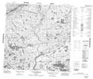
Maps showing Coude Sangumaniq, Rivière-Koksoak; Kativik, Quebec
Coude Sangumaniq is a River feature located in Rivière-Koksoak; Kativik, Quebec.
- Latitude: 59° 51' 23'' North (decimal: 59.8563450)
- Longitude: 71° 42' 49'' West (decimal: -71.7134981)
- Topography Feature Category: River feature
- Geographical Feature: Coude
- Canadian Province/Territory: Quebec
- Location: Rivière-Koksoak; Kativik
- Atlas of Canada Locator Map: Coude Sangumaniq
- GPS Coordinate Locator Map: Coude Sangumaniq Lat/Long
Coude Sangumaniq NTS Map Sheets