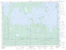
Maps showing Baie Boundary, Roquemaure; Abitibi-Ouest, Quebec
Baie Boundary is a Bay located in Roquemaure; Abitibi-Ouest, Quebec and has an elevation of 272 meters.
- Latitude: 48° 37' 43'' North (decimal: 48.6287026)
- Longitude: 79° 30' 8'' West (decimal: -79.5023318)
- Topography Feature Category: Bay
- Geographical Feature: Baie
- Canadian Province/Territory: Quebec
- Elevation: 272 meters
- Location: Roquemaure; Abitibi-Ouest
- GPS Coordinate Locator Map: Baie Boundary Lat/Long
Baie Boundary NTS Map Sheets