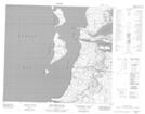
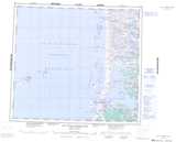
Maps showing Pointe Sikutaaluup Siukanga, Baie-d'Hudson; Kativik, Quebec
Pointe Sikutaaluup Siukanga is a Cape located in Baie-d'Hudson; Kativik, Quebec.
- Latitude: 56° 8' 46'' North (decimal: 56.1461111)
- Longitude: 76° 31' 19'' West (decimal: -76.5219444)
- Topography Feature Category: Cape
- Geographical Feature: Pointe
- Canadian Province/Territory: Quebec
- Location: Baie-d'Hudson; Kativik
- Atlas of Canada Locator Map: Pointe Sikutaaluup Siukanga
- GPS Coordinate Locator Map: Pointe Sikutaaluup Siukanga Lat/Long
Pointe Sikutaaluup Siukanga NTS Map Sheets