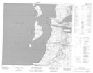
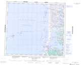
Maps showing Îlot Tursujuup, Baie-d'Hudson; Kativik, Quebec
Îlot Tursujuup is a Island located in Baie-d'Hudson; Kativik, Quebec.
- Latitude: 56° 9' 42'' North (decimal: 56.1616667)
- Longitude: 76° 39' 32'' West (decimal: -76.6588889)
- Topography Feature Category: Island
- Geographical Feature: Îlot / Ilot
- Canadian Province/Territory: Quebec
- Location: Baie-d'Hudson; Kativik
- Atlas of Canada Locator Map: Îlot Tursujuup
- GPS Coordinate Locator Map: Îlot Tursujuup Lat/Long
Îlot Tursujuup NTS Map Sheets