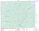
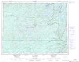
Maps showing Portage Mellii Kaapishhaak, Baie-James; Jamésie, Quebec
Portage Mellii Kaapishhaak is a Road feature located in Baie-James; Jamésie, Quebec and has an elevation of 379 meters.
- Latitude: 50° 19' 55'' North (decimal: 50.3319444)
- Longitude: 74° 23' 17'' West (decimal: -74.3880556)
- Topography Feature Category: Road feature
- Geographical Feature: Portage
- Canadian Province/Territory: Quebec
- Elevation: 379 meters
- Location: Baie-James; Jamésie
- Atlas of Canada Locator Map: Portage Mellii Kaapishhaak
- GPS Coordinate Locator Map: Portage Mellii Kaapishhaak Lat/Long
Portage Mellii Kaapishhaak NTS Map Sheets