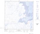
Maps showing Saputiit, Aupaluk; Kativik, Quebec
Saputiit is a River feature located in Aupaluk; Kativik, Quebec.
- Latitude: 59° 17' 15'' North (decimal: 59.2874272)
- Longitude: 69° 37' 33'' West (decimal: -69.6259308)
- Topography Feature Category: River feature
- Geographical Feature: Lieux de pêche
- Canadian Province/Territory: Quebec
- Location: Aupaluk; Kativik
- Atlas of Canada Locator Map: Saputiit
- GPS Coordinate Locator Map: Saputiit Lat/Long
Saputiit NTS Map Sheets