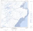
Maps showing Havre Umiakkuvinga, Rivière-Koksoak; Kativik, Quebec
Havre Umiakkuvinga is a Bay located in Rivière-Koksoak; Kativik, Quebec.
- Latitude: 59° 44' 7'' North (decimal: 59.7352076)
- Longitude: 69° 35' 7'' West (decimal: -69.5853554)
- Topography Feature Category: Bay
- Geographical Feature: Baie
- Canadian Province/Territory: Quebec
- Location: Rivière-Koksoak; Kativik
- GPS Coordinate Locator Map: Havre Umiakkuvinga Lat/Long
Havre Umiakkuvinga NTS Map Sheets