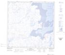
Maps showing Baie Kangirsualuk, Rivière-Koksoak; Kativik, Quebec
Baie Kangirsualuk is a Bay located in Rivière-Koksoak; Kativik, Quebec.
- Latitude: 59° 29' 19'' North (decimal: 59.4885415)
- Longitude: 69° 43' 57'' West (decimal: -69.7325933)
- Topography Feature Category: Bay
- Geographical Feature: Baie
- Canadian Province/Territory: Quebec
- Location: Rivière-Koksoak; Kativik
- Atlas of Canada Locator Map: Baie Kangirsualuk
- GPS Coordinate Locator Map: Baie Kangirsualuk Lat/Long
Baie Kangirsualuk NTS Map Sheets