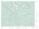
Maps showing Lac du Tambour, Lac-au-Brochet; La Haute-Côte-Nord, Quebec
Lac du Tambour is a Lake located in Lac-au-Brochet; La Haute-Côte-Nord, Quebec.
- Latitude: 49° 6' 35'' North (decimal: 49.1097605)
- Longitude: 69° 21' 15'' West (decimal: -69.3542255)
- Topography Feature Category: Lake
- Geographical Feature: Lac
- Canadian Province/Territory: Quebec
- Location: Lac-au-Brochet; La Haute-Côte-Nord
- Atlas of Canada Locator Map: Lac du Tambour
- GPS Coordinate Locator Map: Lac du Tambour Lat/Long
Lac du Tambour NTS Map Sheets