Canada Topographic Maps

Rivière Ashuapmushuan Topo Maps

Topography maps and Latitude/Longitude Location

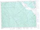
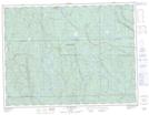
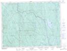
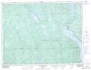
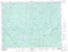
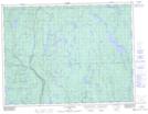
Maps showing Rivière Ashuapmushuan, Saint-Prime; Le Domaine-du-Roy, Quebec

Rivière Ashuapmushuan is a River located in Saint-Prime; Le Domaine-du-Roy, Quebec and has an elevation of 122 meters.

  • Latitude: 48° 37' 3'' North   (decimal: 48.6175406)
  • Longitude: 72° 19' 58'' West   (decimal: -72.3328843)
  • Topography Feature Category: River
  • Geographical Feature: Rivière
  • Canadian Province/Territory: Quebec
  • Elevation: 122 meters
  • Location: Saint-Prime; Le Domaine-du-Roy
  • Atlas of Canada Locator Map: Rivière Ashuapmushuan
  • GPS Coordinate Locator Map: Rivière Ashuapmushuan Lat/Long

Rivière Ashuapmushuan NTS Map Sheets

032A09 Roberval Topographic Map at 1:50,000 scale

032A10 Notre-Dame-De-La-Dore Topographic Map at 1:50,000 scale

032A14 Lac Beland Topographic Map at 1:50,000 scale

032A15 Normandin Topographic Map at 1:50,000 scale

032H03 Lac D'Anville Topographic Map at 1:50,000 scale

032H04 Lac Chigoubiche Topographic Map at 1:50,000 scale

032H05 Lac Aigremont Topographic Map at 1:50,000 scale

032H06 Lac Desautels Topographic Map at 1:50,000 scale

032A Roberval Topographic Map at 1:250,000 scale

032H Riviere Mistassini Topographic Map at 1:250,000 scale

 
Buy Topographic Maps DVD
Newsletter Sign-up

Yes, I want to receive map store discounts.


Bookmark and Share