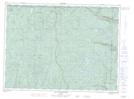
Maps showing Lac du Courlis, Lac-Pikauba; Charlevoix, Quebec
Lac du Courlis is a Lake located in Lac-Pikauba; Charlevoix, Quebec.
- Latitude: 47° 50' 43'' North (decimal: 47.8452778)
- Longitude: 70° 31' 56'' West (decimal: -70.5322222)
- Topography Feature Category: Lake
- Geographical Feature: Lac
- Canadian Province/Territory: Quebec
- Location: Lac-Pikauba; Charlevoix
- Atlas of Canada Locator Map: Lac du Courlis
- GPS Coordinate Locator Map: Lac du Courlis Lat/Long
Lac du Courlis NTS Map Sheets