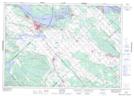
Maps showing Île Greene, Pontiac; Les Collines-de-l'Outaouais, Quebec
Île Greene is a Island located in Pontiac; Les Collines-de-l'Outaouais, Quebec and has an elevation of 62 meters.
- Latitude: 45° 28' 44'' North (decimal: 45.4788889)
- Longitude: 76° 17' 1'' West (decimal: -76.2836111)
- Topography Feature Category: Island
- Geographical Feature: Île / Ile
- Canadian Province/Territory: Quebec
- Elevation: 62 meters
- Location: Pontiac; Les Collines-de-l'Outaouais
- Atlas of Canada Locator Map: Île Greene
- GPS Coordinate Locator Map: Île Greene Lat/Long