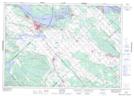
Maps showing Chute Mohr, Pontiac; Les Collines-de-l'Outaouais, Quebec
Chute Mohr is a Rapids located in Pontiac; Les Collines-de-l'Outaouais, Quebec.
- Latitude: 45° 28' 36'' North (decimal: 45.4766667)
- Longitude: 76° 14' 18'' West (decimal: -76.2383333)
- Topography Feature Category: Rapids
- Geographical Feature: Rapides
- Canadian Province/Territory: Quebec
- Location: Pontiac; Les Collines-de-l'Outaouais
- GPS Coordinate Locator Map: Chute Mohr Lat/Long