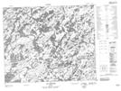
Maps showing Rivière du Feu Est, Baie-James; Jamésie, Quebec
Rivière du Feu Est is a River located in Baie-James; Jamésie, Quebec.
- Latitude: 52° 39' 6'' North (decimal: 52.6516667)
- Longitude: 72° 57' 53'' West (decimal: -72.9647221)
- Topography Feature Category: River
- Geographical Feature: Rivière
- Canadian Province/Territory: Quebec
- Location: Baie-James; Jamésie
- Atlas of Canada Locator Map: Rivière du Feu Est
- GPS Coordinate Locator Map: Rivière du Feu Est Lat/Long
Rivière du Feu Est NTS Map Sheets