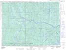
Maps showing Confluent Pitopekw, La Tuque; Le Haut-Saint-Maurice, Quebec
Confluent Pitopekw is a River feature located in La Tuque; Le Haut-Saint-Maurice, Quebec.
- Latitude: 47° 52' 59'' North (decimal: 47.8830556)
- Longitude: 73° 48' 44'' West (decimal: -73.8122221)
- Topography Feature Category: River feature
- Geographical Feature: Confluent
- Canadian Province/Territory: Quebec
- Location: La Tuque; Le Haut-Saint-Maurice
- Atlas of Canada Locator Map: Confluent Pitopekw
- GPS Coordinate Locator Map: Confluent Pitopekw Lat/Long