Maps showing La Grosse Île, Mont-Valin; Le Fjord-du-Saguenay, Quebec
La Grosse Île is a Island located in Mont-Valin; Le Fjord-du-Saguenay, Quebec.
- Latitude: 48° 51' 6'' North (decimal: 48.8516667)
- Longitude: 70° 27' 19'' West (decimal: -70.4552778)
- Topography Feature Category: Island
- Geographical Feature: Île / Ile
- Canadian Province/Territory: Quebec
- Location: Mont-Valin; Le Fjord-du-Saguenay
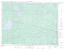
- Atlas of Canada Locator Map: La Grosse Île
- GPS Coordinate Locator Map: La Grosse Île Lat/Long
La Grosse Île NTS Map Sheets