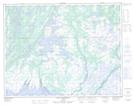
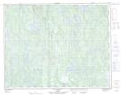
Maps showing Lac Mehtshekuakamau, Lac-Jérôme; Minganie, Quebec
Lac Mehtshekuakamau is a Lake located in Lac-Jérôme; Minganie, Quebec.
- Latitude: 50° 30' 7'' North (decimal: 50.5020113)
- Longitude: 62° 16' 3'' West (decimal: -62.2676061)
- Topography Feature Category: Lake
- Geographical Feature: Lac
- Canadian Province/Territory: Quebec
- Location: Lac-Jérôme; Minganie
- Atlas of Canada Locator Map: Lac Mehtshekuakamau
- GPS Coordinate Locator Map: Lac Mehtshekuakamau Lat/Long
Lac Mehtshekuakamau NTS Map Sheets