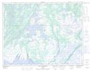
Maps showing Ruisseau Pihu, Aguanish;Minganie, Quebec
Ruisseau Pihu is a River located in Aguanish;Minganie, Quebec and has an elevation of 57 meters.
- Latitude: 50° 15' 36'' North (decimal: 50.2600717)
- Longitude: 62° 17' 44'' West (decimal: -62.2956606)
- Topography Feature Category: River
- Geographical Feature: Rivière
- Canadian Province/Territory: Quebec
- Elevation: 57 meters
- Location: Aguanish;Minganie
- Atlas of Canada Locator Map: Ruisseau Pihu
- GPS Coordinate Locator Map: Ruisseau Pihu Lat/Long
Ruisseau Pihu NTS Map Sheets