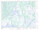
Maps showing Lacs Atamus Kaiapit, Lac-Jérôme; Minganie, Quebec
Lacs Atamus Kaiapit is a Lake located in Lac-Jérôme; Minganie, Quebec.
- Latitude: 50° 23' 27'' North (decimal: 50.3909020)
- Longitude: 62° 3' 39'' West (decimal: -62.0609307)
- Topography Feature Category: Lake
- Geographical Feature: Lacs
- Canadian Province/Territory: Quebec
- Location: Lac-Jérôme; Minganie
- Atlas of Canada Locator Map: Lacs Atamus Kaiapit
- GPS Coordinate Locator Map: Lacs Atamus Kaiapit Lat/Long
Lacs Atamus Kaiapit NTS Map Sheets