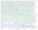
Maps showing Portage Kahkamehtakan, Lac-Jérôme; Minganie, Quebec
Portage Kahkamehtakan is a Road feature located in Lac-Jérôme; Minganie, Quebec.
- Latitude: 50° 24' 39'' North (decimal: 50.4109054)
- Longitude: 62° 46' 48'' West (decimal: -62.7801148)
- Topography Feature Category: Road feature
- Geographical Feature: Portage
- Canadian Province/Territory: Quebec
- Location: Lac-Jérôme; Minganie
- Atlas of Canada Locator Map: Portage Kahkamehtakan
- GPS Coordinate Locator Map: Portage Kahkamehtakan Lat/Long
Portage Kahkamehtakan NTS Map Sheets