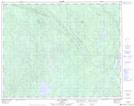
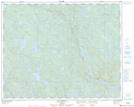
Maps showing Ruisseau Kamatshikueut Uhakamehim, Lac-Jérôme; Minganie, Quebec
Ruisseau Kamatshikueut Uhakamehim is a River located in Lac-Jérôme; Minganie, Quebec.
- Latitude: 51° 30' 13'' North (decimal: 51.5036111)
- Longitude: 62° 58' 40'' West (decimal: -62.9777778)
- Topography Feature Category: River
- Geographical Feature: Ruisseau
- Canadian Province/Territory: Quebec
- Location: Lac-Jérôme; Minganie
- Atlas of Canada Locator Map: Ruisseau Kamatshikueut Uhakamehim
- GPS Coordinate Locator Map: Ruisseau Kamatshikueut Uhakamehim Lat/Long
Ruisseau Kamatshikueut Uhakamehim NTS Map Sheets