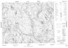
Maps showing Lacs Kakuanaihetshitihk, Petit-Mécatina; Minganie, Quebec
Lacs Kakuanaihetshitihk is a Lake located in Petit-Mécatina; Minganie, Quebec.
- Latitude: 50° 54' 22'' North (decimal: 50.9061878)
- Longitude: 61° 34' 18'' West (decimal: -61.5717379)
- Topography Feature Category: Lake
- Geographical Feature: Lacs
- Canadian Province/Territory: Quebec
- Location: Petit-Mécatina; Minganie
- Atlas of Canada Locator Map: Lacs Kakuanaihetshitihk
- GPS Coordinate Locator Map: Lacs Kakuanaihetshitihk Lat/Long
Lacs Kakuanaihetshitihk NTS Map Sheets