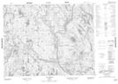
Maps showing Rivière Kukamesiu, Petit-Mécatina; Minganie, Quebec
Rivière Kukamesiu is a River located in Petit-Mécatina; Minganie, Quebec.
- Latitude: 50° 53' 58'' North (decimal: 50.8995219)
- Longitude: 61° 39' 18'' West (decimal: -61.6550739)
- Topography Feature Category: River
- Geographical Feature: Rivière
- Canadian Province/Territory: Quebec
- Location: Petit-Mécatina; Minganie
- Atlas of Canada Locator Map: Rivière Kukamesiu
- GPS Coordinate Locator Map: Rivière Kukamesiu Lat/Long
Rivière Kukamesiu NTS Map Sheets