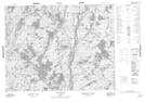
Maps showing Mont Umuas, Lac-Jérôme; Minganie, Quebec
Mont Umuas is a Mountain located in Lac-Jérôme; Minganie, Quebec.
- Latitude: 50° 35' 3'' North (decimal: 50.5842429)
- Longitude: 61° 42' 31'' West (decimal: -61.7086931)
- Topography Feature Category: Mountain
- Geographical Feature: Mont
- Canadian Province/Territory: Quebec
- Location: Lac-Jérôme; Minganie
- Atlas of Canada Locator Map: Mont Umuas
- GPS Coordinate Locator Map: Mont Umuas Lat/Long
Mont Umuas NTS Map Sheets