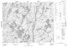
Maps showing Nakamistshetshuant, Lac-Jérôme; Minganie, Quebec
Nakamistshetshuant is a Unincorporated area located in Lac-Jérôme; Minganie, Quebec.
- Latitude: 50° 43' 25'' North (decimal: 50.7236878)
- Longitude: 61° 38' 40'' West (decimal: -61.6445221)
- Topography Feature Category: Unincorporated area
- Geographical Feature: Lieu-dit
- Canadian Province/Territory: Quebec
- Location: Lac-Jérôme; Minganie
- Atlas of Canada Locator Map: Nakamistshetshuant
- GPS Coordinate Locator Map: Nakamistshetshuant Lat/Long
Nakamistshetshuant NTS Map Sheets