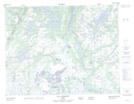
Maps showing Chute Patetaht, Petit-Mécatina; Minganie, Quebec
Chute Patetaht is a Falls located in Petit-Mécatina; Minganie, Quebec.
- Latitude: 50° 25' 30'' North (decimal: 50.4250739)
- Longitude: 61° 42' 5'' West (decimal: -61.7014740)
- Topography Feature Category: Falls
- Geographical Feature: Chute
- Canadian Province/Territory: Quebec
- Location: Petit-Mécatina; Minganie
- Atlas of Canada Locator Map: Chute Patetaht
- GPS Coordinate Locator Map: Chute Patetaht Lat/Long
Chute Patetaht NTS Map Sheets