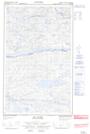
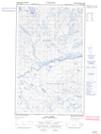
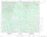
Maps showing Monts Uapahkueh, Lac-Jérôme; Minganie, Quebec
Monts Uapahkueh is a Mountain located in Lac-Jérôme; Minganie, Quebec.
- Latitude: 52° 41' 44'' North (decimal: 52.6955556)
- Longitude: 63° 37' 21'' West (decimal: -63.6225)
- Topography Feature Category: Mountain
- Geographical Feature: Monts
- Canadian Province/Territory: Quebec
- Location: Lac-Jérôme; Minganie
- Atlas of Canada Locator Map: Monts Uapahkueh
- GPS Coordinate Locator Map: Monts Uapahkueh Lat/Long
Monts Uapahkueh NTS Map Sheets