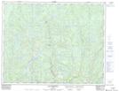
Maps showing Portage Kahihtauekau, Lac-Jérôme; Minganie, Quebec
Portage Kahihtauekau is a Road feature located in Lac-Jérôme; Minganie, Quebec and has an elevation of 537 meters.
- Latitude: 51° 11' 31'' North (decimal: 51.1920096)
- Longitude: 63° 46' 59'' West (decimal: -63.7831687)
- Topography Feature Category: Road feature
- Geographical Feature: Portage
- Canadian Province/Territory: Quebec
- Elevation: 537 meters
- Location: Lac-Jérôme; Minganie
- Atlas of Canada Locator Map: Portage Kahihtauekau
- GPS Coordinate Locator Map: Portage Kahihtauekau Lat/Long
Portage Kahihtauekau NTS Map Sheets