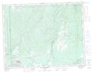
Maps showing District électoral de Ferland, Sept-Îles; Sept-Rivières, Quebec
District électoral de Ferland is a Other municipal/district area - miscellaneous located in Sept-Îles; Sept-Rivières, Quebec.
- Latitude: 50° 16' North (decimal: 50.2666666)
- Longitude: 66° 28' West (decimal: -66.4666666)
- Topography Feature Category: Other municipal/district area - miscellaneous
- Geographical Feature: Circonscription électorale municipale
- Canadian Province/Territory: Quebec
- Location: Sept-Îles; Sept-Rivières
- Atlas of Canada Locator Map: District électoral de Ferland
- GPS Coordinate Locator Map: District électoral de Ferland Lat/Long
District électoral de Ferland NTS Map Sheets