Maps showing Ruisseau Acowictikwan, Baie-Obaoca; Matawinie, Quebec
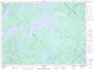
Ruisseau Acowictikwan is a River located in Baie-Obaoca; Matawinie, Quebec.
- Latitude: 47° 21' 58'' North (decimal: 47.3661111)
- Longitude: 74° 10' 7'' West (decimal: -74.1686111)
- Topography Feature Category: River
- Geographical Feature: Ruisseau
- Canadian Province/Territory: Quebec
- Location: Baie-Obaoca; Matawinie
- Atlas of Canada Locator Map: Ruisseau Acowictikwan
- GPS Coordinate Locator Map: Ruisseau Acowictikwan Lat/Long
Ruisseau Acowictikwan NTS Map Sheets