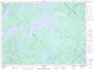
Maps showing Île Matci Natowe, Baie-Obaoca; Matawinie, Quebec
Île Matci Natowe is a Island located in Baie-Obaoca; Matawinie, Quebec.
- Latitude: 47° 28' 0'' North (decimal: 47.4666667)
- Longitude: 74° 15' 13'' West (decimal: -74.2536111)
- Topography Feature Category: Island
- Geographical Feature: Île / Ile
- Canadian Province/Territory: Quebec
- Location: Baie-Obaoca; Matawinie
- Atlas of Canada Locator Map: Île Matci Natowe
- GPS Coordinate Locator Map: Île Matci Natowe Lat/Long
Île Matci Natowe NTS Map Sheets