Maps showing Passe Pirotew Pawctikw, La Tuque; Le Haut-Saint-Maurice, Quebec
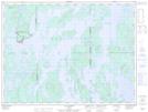
Passe Pirotew Pawctikw is a Channel located in La Tuque; Le Haut-Saint-Maurice, Quebec.
- Latitude: 48° 43' 34'' North (decimal: 48.7261781)
- Longitude: 74° 30' 18'' West (decimal: -74.5051288)
- Topography Feature Category: Channel
- Geographical Feature: Passe
- Canadian Province/Territory: Quebec
- Location: La Tuque; Le Haut-Saint-Maurice
- Atlas of Canada Locator Map: Passe Pirotew Pawctikw
- GPS Coordinate Locator Map: Passe Pirotew Pawctikw Lat/Long
Passe Pirotew Pawctikw NTS Map Sheets