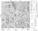
Maps showing Lac Tukimuattuup Qamaninga, Baie-d'Hudson; Kativik, Quebec
Lac Tukimuattuup Qamaninga is a Lake located in Baie-d'Hudson; Kativik, Quebec.
- Latitude: 58° 52' 13'' North (decimal: 58.8702778)
- Longitude: 74° 45' 7'' West (decimal: -74.7519444)
- Topography Feature Category: Lake
- Geographical Feature: Lac
- Canadian Province/Territory: Quebec
- Location: Baie-d'Hudson; Kativik
- Atlas of Canada Locator Map: Lac Tukimuattuup Qamaninga
- GPS Coordinate Locator Map: Lac Tukimuattuup Qamaninga Lat/Long
Lac Tukimuattuup Qamaninga NTS Map Sheets