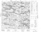
Maps showing Piste Majuqqakallak, Baie-d'Hudson; Kativik, Quebec
Piste Majuqqakallak is a Road feature located in Baie-d'Hudson; Kativik, Quebec.
- Latitude: 58° 33' 23'' North (decimal: 58.5563889)
- Longitude: 75° 48' 42'' West (decimal: -75.8116667)
- Topography Feature Category: Road feature
- Geographical Feature: Piste
- Canadian Province/Territory: Quebec
- Location: Baie-d'Hudson; Kativik
- Atlas of Canada Locator Map: Piste Majuqqakallak
- GPS Coordinate Locator Map: Piste Majuqqakallak Lat/Long
Piste Majuqqakallak NTS Map Sheets