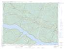
Maps showing Rivière Sainte-Marguerite Nord-Ouest, Mont-Valin; Le Fjord-du-Saguenay, Quebec
Rivière Sainte-Marguerite Nord-Ouest is a River located in Mont-Valin; Le Fjord-du-Saguenay, Quebec and has an elevation of 723 meters.
- Latitude: 48° 24' 8'' North (decimal: 48.4022502)
- Longitude: 70° 16' 59'' West (decimal: -70.2831189)
- Topography Feature Category: River
- Geographical Feature: Rivière
- Canadian Province/Territory: Quebec
- Elevation: 723 meters
- Location: Mont-Valin; Le Fjord-du-Saguenay
- GPS Coordinate Locator Map: Rivière Sainte-Marguerite Nord-Ouest Lat/Long
Rivière Sainte-Marguerite Nord-Ouest NTS Map Sheets