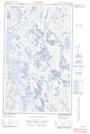
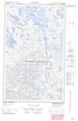
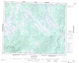
Maps showing Portage Kahtsheuiapuhtshuenakan, Lac-Jérôme; Minganie, Quebec
Portage Kahtsheuiapuhtshuenakan is a Road feature located in Lac-Jérôme; Minganie, Quebec.
- Latitude: 52° 27' 20'' North (decimal: 52.4556188)
- Longitude: 64° 9' 8'' West (decimal: -64.1523142)
- Topography Feature Category: Road feature
- Geographical Feature: Portage
- Canadian Province/Territory: Quebec
- Location: Lac-Jérôme; Minganie
- Atlas of Canada Locator Map: Portage Kahtsheuiapuhtshuenakan
- GPS Coordinate Locator Map: Portage Kahtsheuiapuhtshuenakan Lat/Long
Portage Kahtsheuiapuhtshuenakan NTS Map Sheets