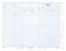
Maps showing Pointe Taukam Itetsheu, Longue-Pointe-de-Mingan; Minganie, Quebec
Pointe Taukam Itetsheu is a Cape located in Longue-Pointe-de-Mingan; Minganie, Quebec.
- Latitude: 50° 12' 52'' North (decimal: 50.2144444)
- Longitude: 63° 58' 56'' West (decimal: -63.9822222)
- Topography Feature Category: Cape
- Geographical Feature: Pointe
- Canadian Province/Territory: Quebec
- Location: Longue-Pointe-de-Mingan; Minganie
- Atlas of Canada Locator Map: Pointe Taukam Itetsheu
- GPS Coordinate Locator Map: Pointe Taukam Itetsheu Lat/Long
Pointe Taukam Itetsheu NTS Map Sheets