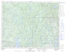
Maps showing Rivière Mitshem Kutshieu, Lac-Jérôme; Minganie, Quebec
Rivière Mitshem Kutshieu is a River located in Lac-Jérôme; Minganie, Quebec.
- Latitude: 50° 40' 42'' North (decimal: 50.6783333)
- Longitude: 63° 40' 19'' West (decimal: -63.6719444)
- Topography Feature Category: River
- Geographical Feature: Rivière
- Canadian Province/Territory: Quebec
- Location: Lac-Jérôme; Minganie
- Atlas of Canada Locator Map: Rivière Mitshem Kutshieu
- GPS Coordinate Locator Map: Rivière Mitshem Kutshieu Lat/Long
Rivière Mitshem Kutshieu NTS Map Sheets