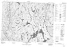
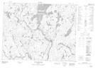
Maps showing Rivière Ashiniu, Chute-des-Passes; Maria-Chapdelaine, Quebec
Rivière Ashiniu is a River located in Chute-des-Passes; Maria-Chapdelaine, Quebec.
- Latitude: 49° 46' 42'' North (decimal: 49.7783333)
- Longitude: 71° 28' 54'' West (decimal: -71.4816667)
- Topography Feature Category: River
- Geographical Feature: Ruisseau
- Canadian Province/Territory: Quebec
- Location: Chute-des-Passes; Maria-Chapdelaine
- Atlas of Canada Locator Map: Rivière Ashiniu
- GPS Coordinate Locator Map: Rivière Ashiniu Lat/Long
Rivière Ashiniu NTS Map Sheets