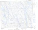
Maps showing Fire Lake, Rivière-Mouchalagane; Caniapiscau, Quebec
Fire Lake is a Unincorporated area located in Rivière-Mouchalagane; Caniapiscau, Quebec.
- Latitude: 52° 20' 5'' North (decimal: 52.3347925)
- Longitude: 67° 21' 56'' West (decimal: -67.3655174)
- Topography Feature Category: Unincorporated area
- Geographical Feature: Lieu-dit
- Canadian Province/Territory: Quebec
- Location: Rivière-Mouchalagane; Caniapiscau
- Atlas of Canada Locator Map: Fire Lake
- GPS Coordinate Locator Map: Fire Lake Lat/Long
Fire Lake NTS Map Sheets