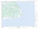
Maps showing Plage des Morses, L'Île-d'Anticosti; Minganie, Quebec
Plage des Morses is a Beach located in L'Île-d'Anticosti; Minganie, Quebec.
- Latitude: 49° 5' 45'' North (decimal: 49.0958333)
- Longitude: 61° 42' 32'' West (decimal: -61.7088889)
- Topography Feature Category: Beach
- Geographical Feature: Plage
- Canadian Province/Territory: Quebec
- Location: L'Île-d'Anticosti; Minganie
- Atlas of Canada Locator Map: Plage des Morses
- GPS Coordinate Locator Map: Plage des Morses Lat/Long
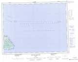
Plage des Morses NTS Map Sheets