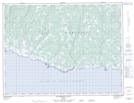
Maps showing La Source-de-Saumure-de-la-Chaloupe, L'Île-d'Anticosti; Minganie, Quebec
La Source-de-Saumure-de-la-Chaloupe is a Unincorporated area located in L'Île-d'Anticosti; Minganie, Quebec.
- Latitude: 49° 12' North (decimal: 49.1999999)
- Longitude: 62° 29' West (decimal: -62.4832999)
- Topography Feature Category: Unincorporated area
- Geographical Feature: Lieu-dit
- Canadian Province/Territory: Quebec
- Location: L'Île-d'Anticosti; Minganie
- Atlas of Canada Locator Map: La Source-de-Saumure-de-la-Chaloupe
- GPS Coordinate Locator Map: La Source-de-Saumure-de-la-Chaloupe Lat/Long
La Source-de-Saumure-de-la-Chaloupe NTS Map Sheets