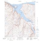
Maps showing Île Tulugarnaq, Baie-d'Hudson; Kativik, Quebec
Île Tulugarnaq is a Island located in Baie-d'Hudson; Kativik, Quebec.
- Latitude: 62° 12' 18'' North (decimal: 62.2050474)
- Longitude: 74° 48' 50'' West (decimal: -74.8139034)
- Topography Feature Category: Island
- Geographical Feature: Rocher
- Canadian Province/Territory: Quebec
- Location: Baie-d'Hudson; Kativik
- GPS Coordinate Locator Map: Île Tulugarnaq Lat/Long
Île Tulugarnaq NTS Map Sheets